
Biodiversity monitoring on subsea cable crossings
- Christy
- Feb 3, 2025
- 3 min read
Updated: Aug 4, 2025
To protect subsea cable crossings from scour and fishing gear, they are covered by a layer of rocks. These rock dumps naturally attract all kinds of species, because they provide hard substrate in an otherwise barren North Sea. Lobster contributed to a research project that is aimed to promote faster settlement of the rock dumps after installations, by applying a different rock type on the cover layer.
On behalf of Wageningen Marine Research, we mapped two cable crossings in detail, each with a different rock type. This data enables researchers to evaluate which type of rock contributes most effectively to biodiversity development around the crossings.
Client: Wageningen Marine Research, leading research institute of the Netherlands
Period: July 2024
Location: North Sea, 15 km offshore, the Netherlands

Key takeaways
During this survey, we:
Completed two successful 20x20m seabed mapping missions over marble and granite stone dumps, covering a total of 1,100 m² in approximately 1 hour and 40 minutes.
Achieved mission success rates of 100%, mapping 520 m² per hour over granite and 580 m² per hour over marble.
Created super high resolution LobsterMaps, where each pixel maps to 1 mm by 1 mm, which are easily accessible through any GIS viewer for further analysis and comparison.
Challenge
Wageningen Marine Research has been gathering data on various marine environments since the 1970s, including the Wadden Sea, Delta, North Sea, freshwater areas like the IJsselmeer and Markermeer, as well as Antarctica and the Caribbean. In their research projects, monitoring plays an important role as it dictates both the budget and often the design of the experiments.
Currently available methods for monitoring are intensive, costly, and ineffective at scale. The use of small ROVs also has deficiencies, requiring expertise and being very sensitive to weather conditions and underwater visibility. Additionally, the process of analyzing the recorded data is difficult and time-consuming. Diving on the cable crossings is possible, but still limited to a narrow timeslot only once every six hours due to the strong tidal currents.
The challenge is to effectively monitor the ecological effects of these two types of stones at cable crossings to support better environmental decisions.
Solution
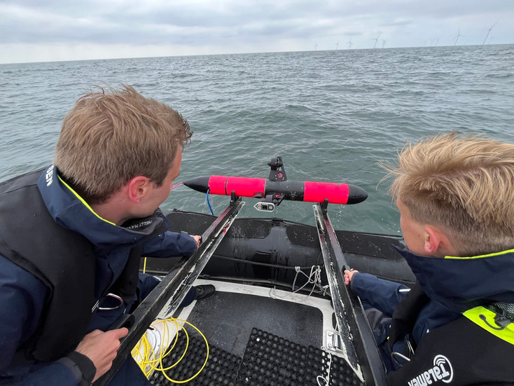
Using our advanced underwater drone, the Scout 2, we conducted a detailed survey over the cable crossing area. The Scout carried out high-resolution mapping at an altitude of 1.0m above the seabed. Once processed into the LobsterMaps, this data allows researchers to effectively examine the differences between areas covered with granite and those with marble.
Survey process: using the Lobster Remote, the Scout is activated and the missions are started. The operator has to do nothing except press a button. Once the Scout finishes a mission, the operator starts the next mission, until everything is completed. The water depth was 21 meters.
Survey Data: In just one hour and forty minutes, the team successfully completed two missions, capturing data from two areas measuring 20 x 20 meters each. Every area took the Scout about 30 minutes to fully map.
Data Processing: Following the survey, the Scout was connected to Lobster's server to facilitate the download and processing of the collected data. Subsequently, the LobsterMaps were made available to WMR for their analysis.
Here you can see a part of the Lobster Map we created!
A close-up of the underwater ecosystem at the cable crossing

Zooming in even further, all the tiny details become clear.

Impact
Contributing to this project with the high resolution LobsterMaps helps WMR and their partners not only to compare the effect of the different rock types on settlement, but also to showcase the sheer amount of life already supported by these installations. As a team, we hope that our data helps a wider audience become more aware of the amazing underwater ecosystems that are right off the coast in the Netherlands. Fostering and strengthening these is not some abstract policy anymore, it is exceedingly visible thanks to the Scouts clear images!
Behind The Scenes


Partners


